Forest inventory technology will use orbital remote sensing
23 de outubro de 2018By Claudia Izique | FAPESP Research for Innovation – Visiona Tecnologia Espacial, a joint venture between Brazilian state-owned enterprises Telebras (Telecomunicações Brasileiras) and Embraer (Empresa Brasileira de Aeronáutica, via its Defense and Security division), is partnering with Canada’s Tesera System Inc. to develop a forest inventory system for Brazilian pulp and paper producers based on orbital remote sensing to produce optical and radar images.
The project was selected in a call issued by FAPESP and the National Research Council Canada (NRC). To implement it, Visiona will receive funding from FAPESP under its Innovative Research in Small Business Program (PIPE), and Tesera will be supported by the Canadian International Innovation Program (CIIP).
The main market for this technology is the pulp and paper industry, which uses field teams to inventory forest fragments of approximately 2.7 million hectares at least once a year to profile the vegetation and analyze its potential for managed use.
“The traditional system is labor intensive, as data collection is performed extensively, albeit by sampling, and large companies need to have a dedicated department for interpreting these inventories. The use of remote sensing, machine-learning algorithms and mathematical computation reduces the amount of field work, saving time and money, and enables the information to be delivered in accordance with the specifications of each customer,” says Cleber Gonzales de Oliveira, Visiona’s head of contracts and business development.
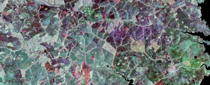
The project combines the expertise of Visiona, which already offers the market a variety of orbital remote sensing data, including optical images and radar images in different bands (X, C, and L), with that of Tesera, which predominantly uses a combination of airborne LiDAR (light detection and ranging) and optical data collected by aircraft or Earth observation satellites. LiDAR systems illuminate a target area with pulsed laser light, producing images in the visible and infrared ranges. Tesera uses machine-learning techniques to analyze these images for the Canadian forestry industry.
“We observe, quantify and assess forest volume, the number of trees, and even the species composition in a given area,” says Julianno Sambatti, a data scientist with Tesera.
In April 2018, Visiona and Tesera presented the project to prospective Brazilian customers – giants of the pulp industry such as Klabin, Suzano and Fibria, among others – and companies based in other countries during Expoforest in Santa Rita do Passa Quatro, São Paulo State. “We spoke nonstop for three hours to Brazilians, Argentinians, Uruguayans and Peruvians,” Sambatti recalls.
“They were all very interested. We’re negotiating with two large companies to share field data so we can tailor the service to their requirements,” Oliveira says.
Customers will have access to data obtained via optical imaging in four and eight spectral bands, telling them about plant health or expected production, for example, as well as radar imaging in the C and L bands, the latter of which is capable of penetrating the forest structure to ground level so that the height of the vegetation can be determined. “The integration of optical and radar information serves as a basis for computing the volume of timber per plot,” Oliveira explains. The minimum coverage area for each unit of the research project will be 10,000 hectares. The two companies expect to complete the project by July 2019.
Global market
Visiona, with 50 employees, was founded in 2012 to operate as an integrator of space systems, especially Brazil’s Geostationary Defense and Communications Satellite (SGDC), which was launched in 2017 under the aegis of the government’s Internet for All program.
“In 2015, following a decision made by the board, the company also began operating in earth observation,” Oliveira says. The company added satellite imaging to its existing expertise and capabilities in telecom and signed agreements with six major global players: Airbus Defense & Space, DigitalGlobe, MDA, SI Imaging Services, Restec, and Urthecast.
“We began offering remote sensing solutions for sectors such as agriculture, environmental management, and oil and gas, among others,” Oliveira says. For example, Petrobras uses Visiona’s services to monitor oilfields.
Tesera, which was founded 25 years ago and has 20 employees, offers its high-resolution inventory solution (HRIS) to Canada’s forestry industry via consulting, cloud-based services and SaaS (software as a service), and data analytics. “We now want to expand our market share with a larger range of products and services,” Sambatti says.
Sambatti and Oliveira believe that the product the two companies are developing is “an innovation for the global market”. Initially, the focus is on the South American pulp and paper industry. “But we’re also thinking about markets in Africa and Asia,” Oliveira says.
Based in São José dos Campos, São Paulo State, and Calgary, Alberta, the two companies will deploy information and communications technologies (ICT) to work together and exchange data. Sambatti is perfectly familiar with Brazil, with a degree in agronomy from the University of São Paulo’s Luiz de Queiroz College of Agriculture (ESALQ-USP) in Piracicaba. He also has a PhD in ecology from the University of California, Davis. He has had a scholarship from FAPESP and worked at Bradar, another São José dos Campos-based firm eventually acquired by Embraer, before moving to Canada.
Company: Visiona Tecnologia Espacial
Site: www.visionaespacial.com.br
Tel: +55 12 2138-5801
Contact: contato@visionaespacial.com.br
Empresa: Tesera System Inc.
Site: tesera.com
Contact: info@tesera.com